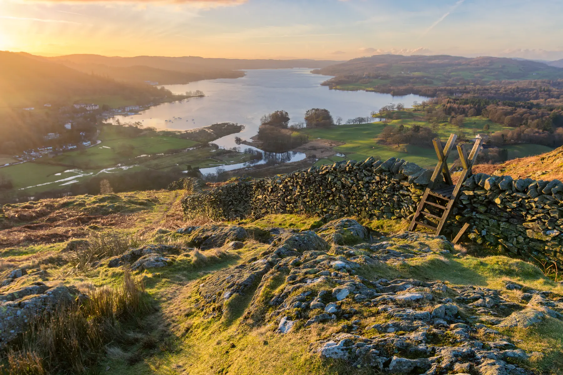
Windermere the town sits above Windermere the lake, and the confusion between the two is the first thing to sort out: the town is a Victorian railway settlement on the hill, Bowness-on-Windermere is the lakeside village a mile below it, and the lake itself is eighteen kilometres long — the largest in England.
The walking splits accordingly. There are short hills immediately behind the town with views that are out of all proportion to the effort. There is the west shore, quiet and wooded and reached by ferry. And there are the fells beyond, which are the Lake District proper.
Distances are from Windermere town.
The one to do first, and the most important short walk in the Lake District. A path leaves the A591 directly opposite the station and climbs through woodland for about twenty minutes to a rocky knoll at 238 metres.
From the top the whole of Windermere is laid out below with the Coniston fells, the Langdale Pikes and — on a clear day — Scafell beyond.
It matters because of what happened here in 1930, when a twenty-three-year-old Blackburn council clerk called Alfred Wainwright walked up on his first visit to the Lakes, looked at that view, and had what he described as a moment that changed his life. He went on to write the seven Pictorial Guides to the Lakeland Fells that shaped how the whole of Britain walks in these hills.
Forty-five minutes round trip. There is now a bench and a viewfinder. See our Orrest Head page.
The other short hill, east of the town, at 232 metres — a twenty-minute climb from the edge of Windermere with a tarn below the summit and a view west over the lake to the Coniston fells. It is much quieter than Orrest Head and about as good.
Above Bowness, and the third of the trio. A short steep climb to a rocky top with the lake immediately below and Belle Isle in the middle of it. Under an hour from Bowness.
From Bowness, paths run north along the shore through Cockshott Point — National Trust, with an open field running down to the water — and on to Millerground and Brockhole, the national park’s visitor centre with its gardens dropping to the lake.
Windermere to Brockhole and back along the shore is about two hours, mostly level.
South from Bowness, the shore path continues towards Storrs and eventually Fell Foot at the southern end.
The best lakeside walking, and it needs a boat. The Windermere ferry — a chain ferry carrying cars and foot passengers — crosses from Bowness to Far Sawrey in a few minutes, and from the far side a network of paths runs through the woods of Claife Heights along the western shore.
Claife Viewing Station, restored by the National Trust, is a Georgian folly built so that eighteenth-century tourists could look at the lake through coloured glass, each pane representing a different season. It is free and the view from it is still the point.
The west shore is quiet, wooded and almost entirely undeveloped, which is a startling contrast to the eastern side.
Latterbarrow, above Hawkshead, is a short climb to a cairn with one of the best views in the southern Lakes.
Eight kilometres north at Ambleside. A twenty-metre waterfall in a wooded ravine, reached by a fifteen-minute walk from the middle of the town on a good path — one of the easiest waterfalls to get to in the Lake District and one of the best. It powered the town’s mills, which is why Ambleside is where it is. See our Stock Ghyll Force page.
Ambleside also has the Bridge House, a tiny building straddling a beck, and the remains of a Roman fort at Waterhead by the lake.
Beyond Ambleside, Rydal Water and Grasmere with the Coffin Route between them, Rydal Cave — an enormous quarried cavern you can walk into — and Wordsworth’s houses at Rydal Mount and Dove Cottage.
The Loughrigg Terrace walk above Grasmere gives the classic view down the lake and is the best short walk in the central Lakes.
Hawkshead, five kilometres west across the ferry, is a village of whitewashed cottages and squares with Beatrix Potter and Wordsworth associations.
Tarn Hows, above it, is a National Trust tarn ringed by conifers with a level surfaced path all the way round — about three kilometres, accessible, and one of the most photographed places in the Lake District. It is also, entirely, an artificial landscape created in the nineteenth century, which does not make it less lovely.
Grizedale Forest, south of Hawkshead, has waymarked walking and mountain biking trails and sculptures in the woods.
Windermere is a base rather than a mountain village, but the fells are close. The Fairfield Horseshoe from Ambleside, Wansfell Pike above Troutbeck, the Kentmere Round and the Coniston fells are all within half an hour, and the Langdale Pikes and Scafell are an hour.
For a first fell from Windermere, Wansfell Pike above Ambleside — three hours round trip, steep and rewarding — is the usual answer.
Getting to the trailheads. The 555 bus runs the length of the A591 from Kendal through Windermere and Ambleside to Grasmere and Keswick; the 599 open-top runs Bowness to Grasmere in season. The Windermere ferry crosses to the west shore. And the lake cruises land at Ambleside, Lakeside and Brockhole, which turns a boat into a walking shuttle.
Parking at the popular spots — Tarn Hows, Stock Ghyll, Ambleside — fills by mid-morning in season.
The fells are serious. Check a mountain forecast rather than a valley one.
Underfoot. The Claife Heights paths and the woodland tracks are muddy after rain; the fell paths are rocky.
Spring is the best-kept secret: daffodils along Ullswater and Grasmere, the fells green, the waterfalls still full from winter, and the paths far emptier than in August.
Summer brings long evenings, which is the real advantage — a walk up Orrest Head or Wansfell at six in the evening avoids both the crowds and the heat, and the light on the lake at nine is the best of the year. It also brings full car parks everywhere and midges in the woods.
Autumn is the connoisseur’s season. The oak and birch turn, the light goes low and gold, and Tarn Hows and the Claife woods look their best. Days shorten fast — by late October you want to be off the fells by four.
Winter puts snow on the tops and empties the valleys. The low-level walks — the shore paths, Tarn Hows, Stock Ghyll — are at their quietest and most atmospheric, and the boats still run.
Worth stating plainly, because Windermere is a gentle base with serious mountains twenty minutes away. Lake District mountain rescue teams are among the busiest in Britain, and the pattern is consistent: people underestimate the time, run out of daylight, or lose the path in cloud.
Carry a paper map and compass and know how to use them; phone batteries fail in the cold. Check a mountain forecast rather than a valley one — cloud base is the number that matters. Tell someone where you are going. And be willing to turn round, which is the hardest part.
The low-level walks in this guide need none of that. The fells above them do.
Orrest Head, twenty minutes from the station, for the view that made Wainwright a fell-walker. It is the best short walk in the Lake District.
There is no continuous shoreline path around the whole lake, but there are long stretches on both shores. The west shore from the ferry is the quieter and better half.
The Windermere ferry from Bowness, a chain ferry carrying cars and foot passengers, takes a few minutes.
Stock Ghyll Force at Ambleside, eight kilometres north, is a twenty-metre fall a fifteen-minute walk from the town centre.
Wansfell Pike above Ambleside — three hours, steep, and with the whole lake below you at the top.